This post contains affiliate links. If you book a rental car or tour through one of them, we may earn a small commission at no extra cost to you.
Kyushu’s easternmost point isn’t a famous cape with tour buses lined up — it’s a narrow, winding mountain road out to the tip of the Tsurumi Peninsula in Saiki City, ending at a lighthouse, a long steel footbridge stretching out over the cliffs, and, if you look closely, the quiet ruins of a WWII gun battery built into the hillside. Tsurumisaki Nature Park (鶴御崎自然公園) is about as far from the well-trodden Kyushu route as you can drive.
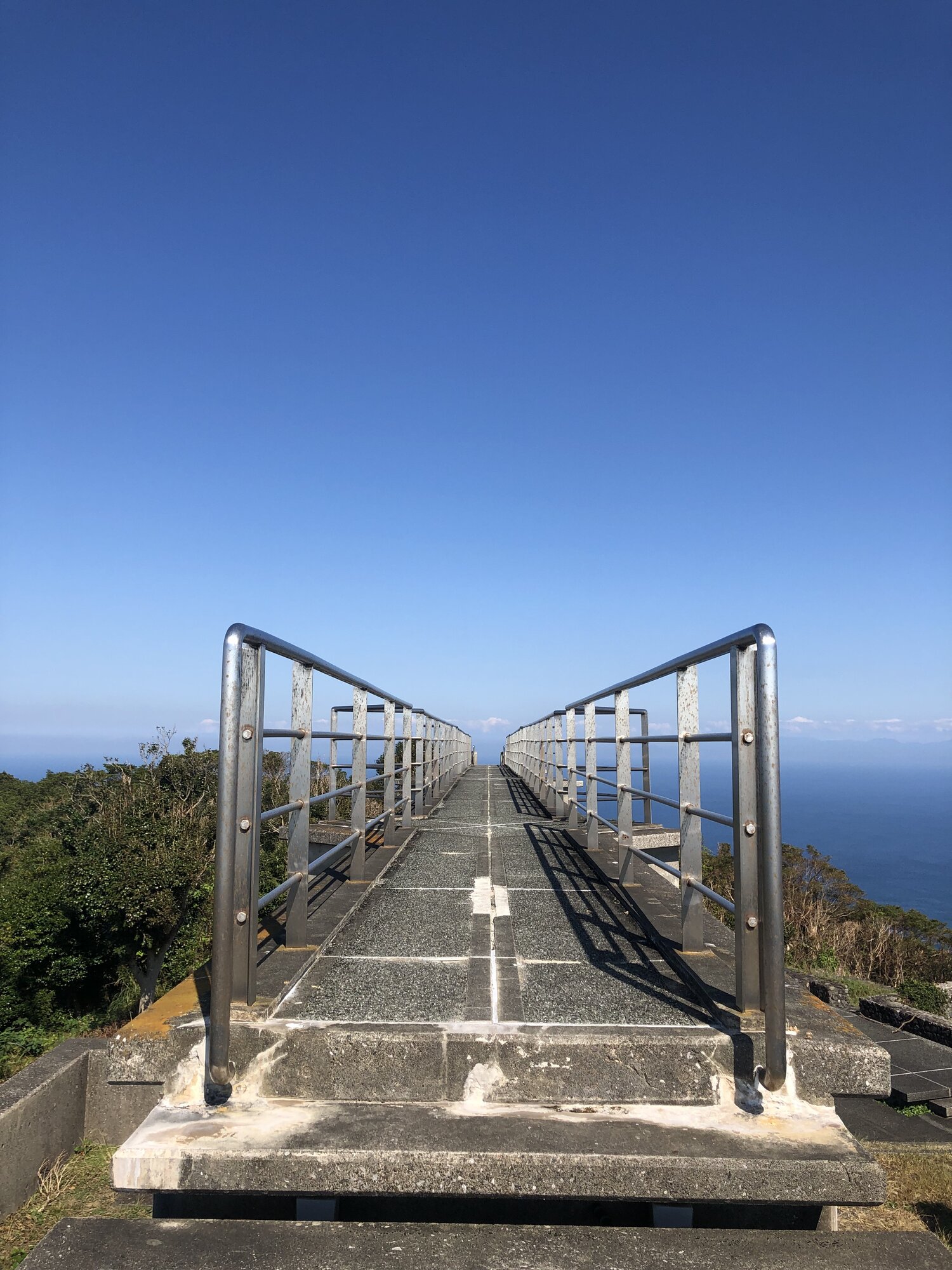
The Easternmost Point of Kyushu
鶴御崎 (Tsurumisaki) sits at the tip of the Tsurumi Peninsula in Saiki City — not to be confused with the nearby Saganoseki Peninsula further north, which has its own separate lighthouse and its own separate WWII battery ruins. Tsurumisaki is consistently described by Oita and Saiki tourism sources as mainland Kyushu’s easternmost point, looking out across the Bungo Channel (豊後水道) toward Shikoku. On a clear day, the Sada Peninsula on the Ehime side is visible from the observation bridge. It’s also promoted locally as one of the first places in Kyushu to see the sunrise each New Year’s Day.
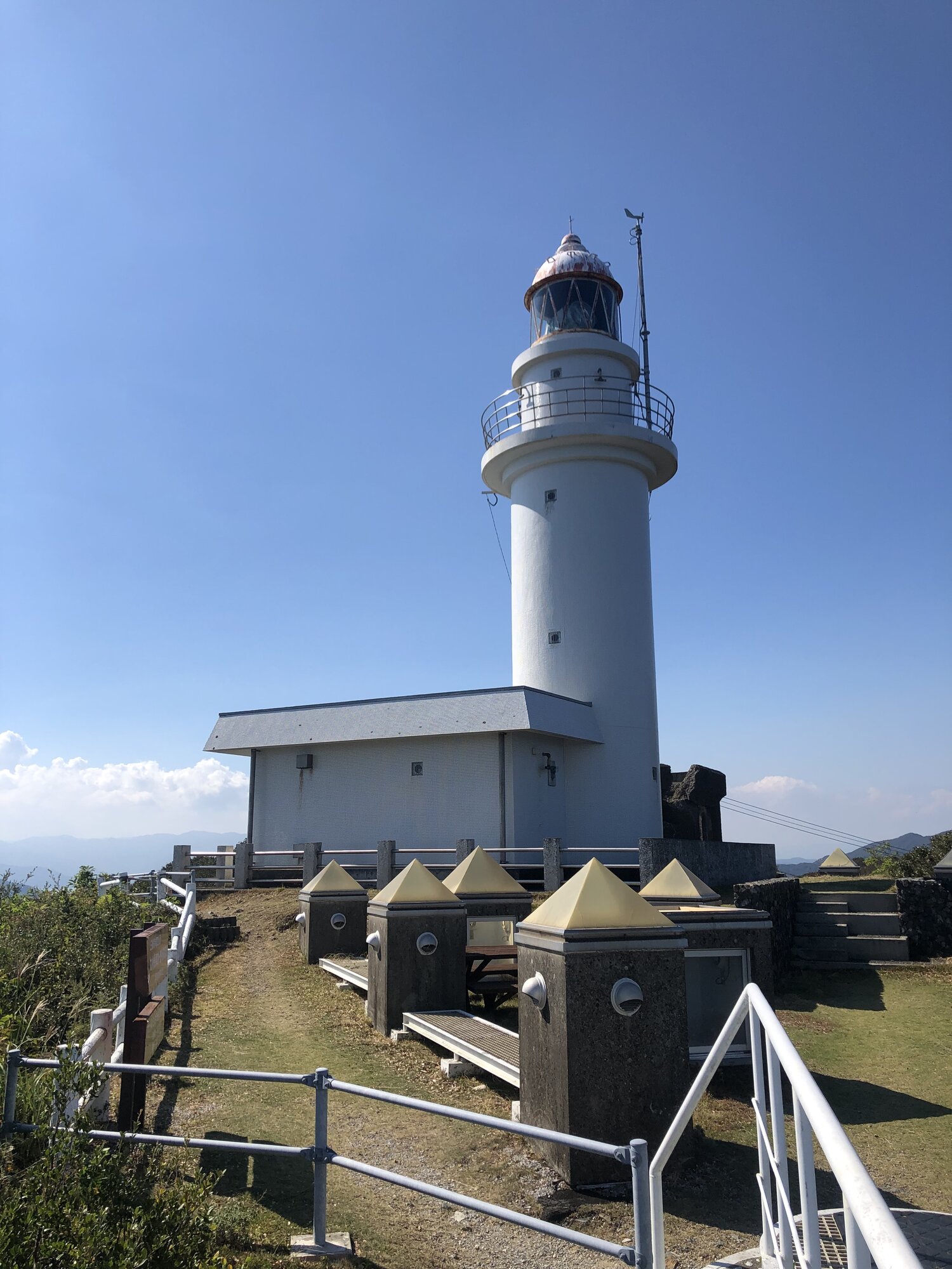
The white lighthouse marking the point, 鶴御埼灯台, is actually fairly modern — first lit in March 1981 — but it stands on ground with a much older military history: the site of a former Imperial Japanese Navy watchtower built in 1894, right after the First Sino-Japanese War.
Walking Out on the Observation Bridge
The park’s centerpiece is a long, straight steel pedestrian bridge (built around 1991) that extends out from the cliff toward open ocean, with nothing but sky and water at the far end until you’re standing on it. It connects to a circular observation platform with a coin-operated telescope, looking down over a genuinely rugged stretch of coastline — jagged little rock islands, cliffs, and, on a clear day, Shikoku in the distance across the strait.

The War Still Hiding in the Hillside
What makes this cape more than just a scenic viewpoint is what’s built into the ground around it. During the Pacific War this headland was part of the 豊予要塞 (Bungo Fortress), a coastal artillery network built to defend the Bungo Channel between Kyushu and Shikoku — 13 battery sites and 46 guns in total across both shores. The Tsurumisaki position itself was fortified starting in the 1920s, with four 15cm cannons installed here in 1942. The fortress never fired on an enemy; its only recorded casualties came from a tragic accident during a live-fire exercise in January 1942, when a gun barrel ruptured and killed 16 people, including the regiment commander.
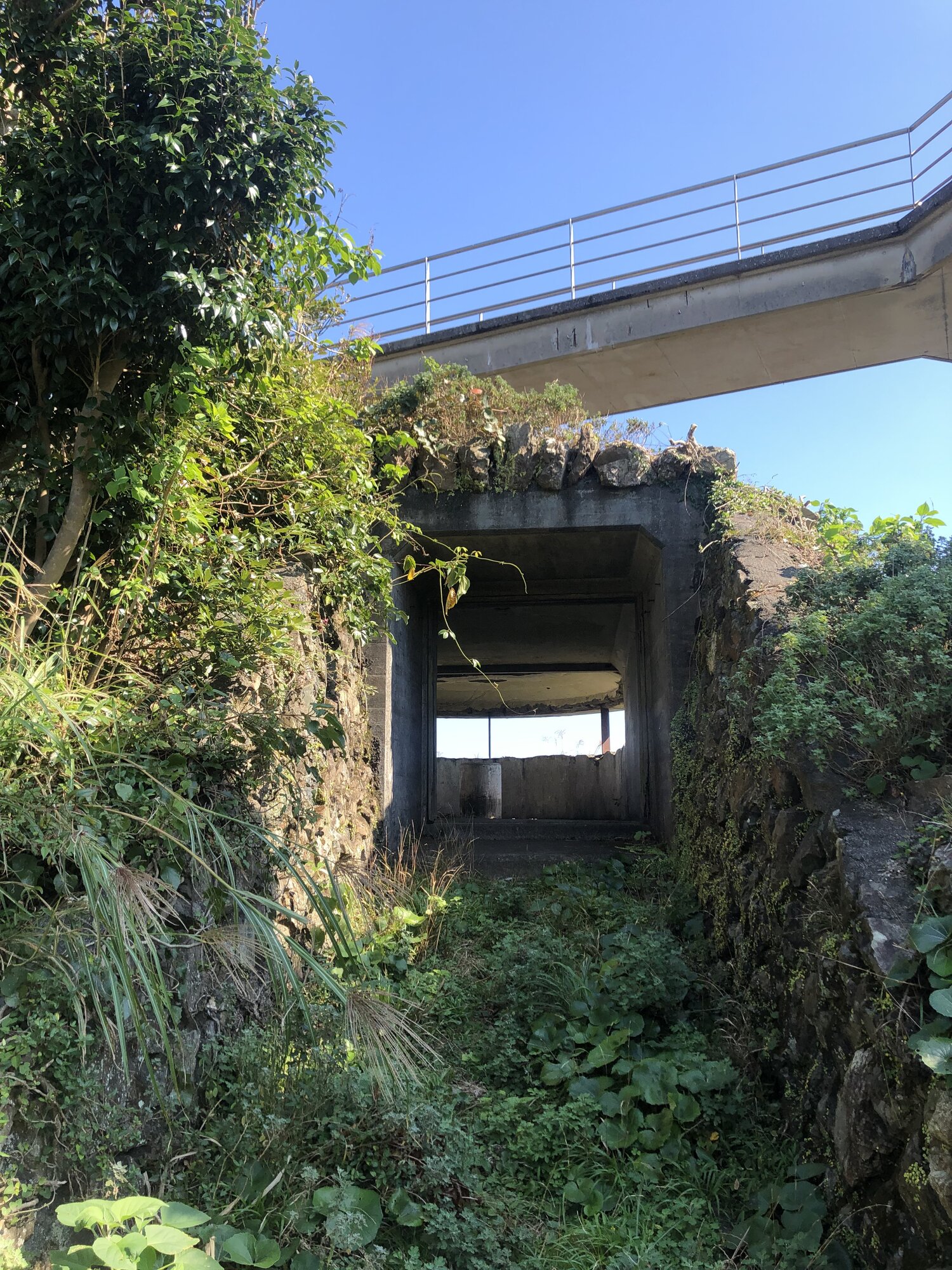
We came across a section where the modern bridge passes almost directly over one of the old concrete emplacements — an odd, striking juxtaposition of a leisure structure and a war ruin sharing the same small patch of cliff. An on-site sign nearby makes the history explicit:

“Even now, traces of war remain. This entire area contains the remains of gun batteries and air-raid shelters built during the Pacific War. You’ll be amazed at the excellent construction achieved with the limited materials of the time. Do not enter dangerous areas!”
There’s no museum or guided tour here — this isn’t an officially curated war-heritage site, just ruins left largely as they were, documented mostly by history enthusiasts rather than any formal program. That’s part of what makes finding them, half-swallowed by vines and forest, feel like a genuine discovery rather than a managed exhibit.
Visiting Tsurumisaki
Cost: Free
Hours: Open-air park, no gate — accessible during daylight
Parking: Free lot at the park (capacity estimates vary by source, roughly 30–80 spaces)
Access: Car essential — narrow winding mountain roads for the final stretch; public transit stops well short of the park (over an hour’s walk from the nearest bus stop)
Driving time: Roughly 1–1.5 hours from Saiki city center; plan for 2.5+ hours from central Oita or Beppu
Caution: Old military ruins are not maintained for visitor safety — stay out of any area that looks unstable or is marked off-limits
Getting There
Tsurumisaki is remote even by the standards of this site — it’s a genuine edge-of-Kyushu destination, reached via narrow coastal and mountain roads with no realistic public transit option. A rental car is essential; see our guide to the Yamanami Highway and why you need a car for IDP and rental car basics.
Leave a Reply